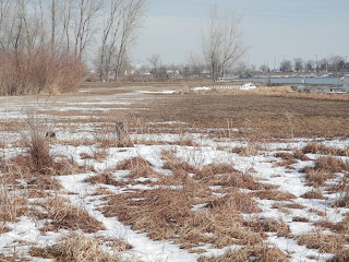
The survey to indicated the boundary line for property on the eastern extent of Carter Lake has been completed. There are numerous lathes prominent along the side of the lake, especially on the western extent of the lakes' eastern section.
The markers indicate that a relatively large section of land is within the Nebraska boundary, and therefore not Iowa property. One particular area has a variety of settings, including lowland habitat adjacent to the lake waters, mud flats when the water level is kept low.
How the parcel areas, apparently within the boundaries of the City of Omaha will be permanently classified by the Douglas County assessor is not yet known. At least two parcels are associated with an Iowa homeowner yard, and where the lake-edge was filled and the bank anchored by rip-rap to allow establishment of a lawn. Another tiny parcel is on the west side of the Iowa West Ranch. There are decrepit bock docks at one particular area, and since the City of Omaha does not allow private construction on public property, perhaps they will be removed and the site restored to a condition similar to what occurs adjacent.
There needs to be a legally binding decision to ensure that these unique parts of the Carter Lake environs continue to be a green space, and not land in limbo where Iowans have done what they wanted for so many years.
The area has been obviously indicated at land within Nebraska. Its permanent fate is pending, though there is some indication the land will be marked, and become park of Levi Carter Park. No written confirmation of this is available. Several calls to the acting director office of the Omaha Parks and Recreation Department to determine the outcome of the land survey have not been returned.
The City of Carter Lake also owns property within the area, so perhaps a dedicated green-space could be established, and provide a new place where people can enjoy a different view of the lake and its birds.
Stateline Property at East Carter Lake
Mud flat at the lakeside portion of the area.
One of the many temporary markers indicating the state boundary.
The stateline boundary markers are visible on the left portion of this picture.
Private docks on Nebraska land, east Carter Lake.


